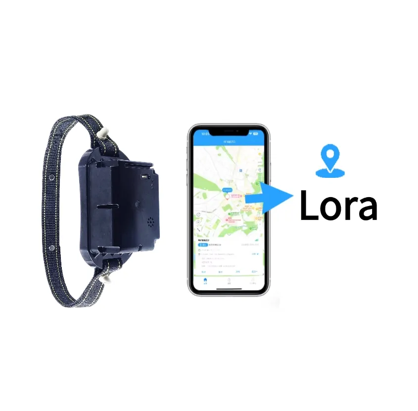
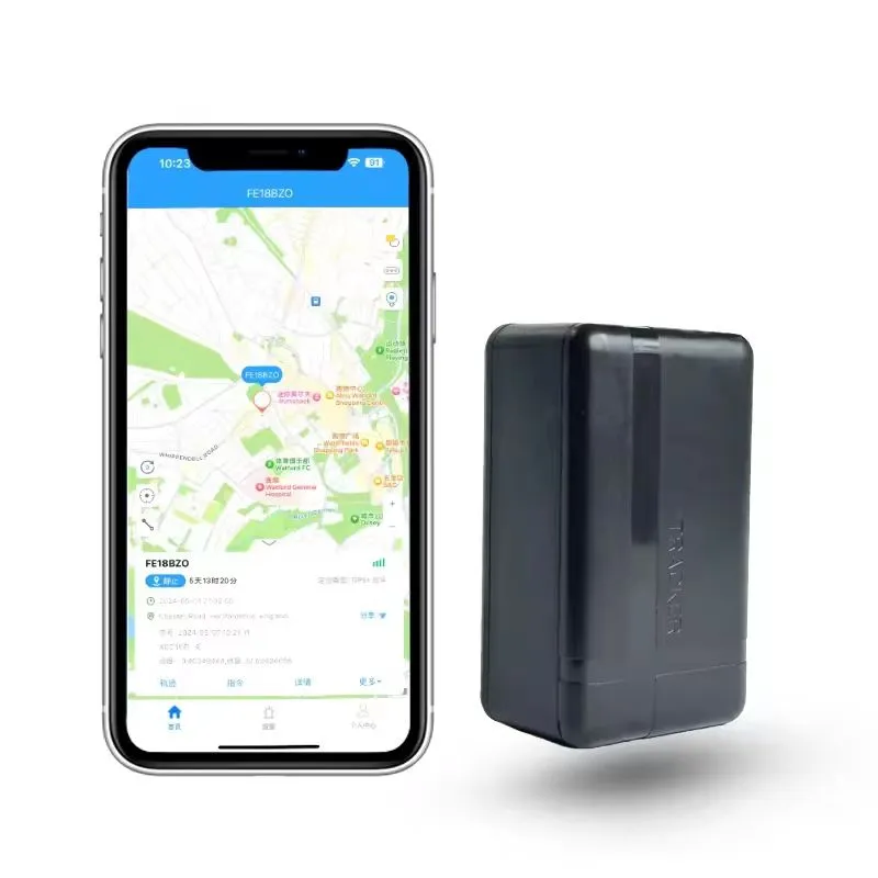
White Label GPS Tracking Platform with Custom App, API and Private Server

Custom white-label GPS tracking platform with branded Android and iOS apps, real-time monitoring, geofencing, alarm management, API integration and private server deployment.

Project objectives

White Label GPS Tracking PlatformCustom GPS Tracking SoftwareBranded Web Management PortalCustom Android ApplicationCustom iOS ApplicationCustom Domain and LogoMulti-Tenant Account ManagementDistributor and Reseller AccountsReal-Time Device MonitoringHistorical Route PlaybackElectronic Geofence ManagementDevice Alarm ManagementRemote Command DeliveryGPS Device Protocol IntegrationThird-Party Device IntegrationAPI and SDK IntegrationPrivate Server DeploymentCloud and On-Premise OptionsMulti-Language User InterfaceGoogle Maps IntegrationAmap IntegrationRole-Based Access ControlDevice Subscription ManagementScalable Distributed ArchitectureHigh-Concurrency Device AccessMillion-Device ArchitectureOEM and ODM Development

Custom white-label GPS tracking platform with branded Android and iOS apps, real-time monitoring, geofencing, alarm management, API integration and private server deployment.

White Label GPS Tracking Platform

A White Label GPS Tracking Platform enables GPS hardware manufacturers, distributors, tracking service providers and enterprise customers to operate a complete tracking service under their own brand.

The solution includes a customizable web management portal, Android and iOS applications, device communication services, protocol integration, real-time maps, historical routes, geofences, alarms, reports, APIs and optional private server deployment.

Instead of building an entire GPS software ecosystem from the beginning, customers can start with a proven platform and customize its branding, functions, languages, device protocols and business processes.

Complete Brand Customization

The platform can display the customer’s company name, logo, brand colors, domain name, support details and legal information.

Android and iOS applications can also use customized names, icons, splash screens, interface colors and store descriptions. Customers can publish the applications through their own developer accounts according to the requirements of Google Play and the Apple App Store.

Email templates, notification text, login pages, downloadable reports and customer-facing documents can be adapted to match the brand identity.

This provides a consistent experience across the web platform, mobile applications and tracking devices.

Real-Time GPS Monitoring

The real-time monitoring interface displays the latest location and status of connected GPS devices.

Depending on the device protocol, the platform can show latitude, longitude, speed, direction, positioning time, communication time, ACC ignition, external power, battery level, network status and sensor information.

Devices can be organized by customer, fleet, department, project, asset type or geographic region. Users can search by device name, IMEI, serial number, vehicle registration, employee name or another configured identifier.

The map can display individual devices, selected groups or all devices that the user has permission to access.

Historical Route Playback

The platform stores location records and allows users to review device movement during a selected period.

Route playback can display movement points, stops, parking duration, speed and alarm events when this information is supported by the device.

Historical data can be filtered by device, time range, organization, alarm type or operating status. Reports can be exported according to the customer’s permission and retention policies.

The system can use ClickHouse to support large-scale storage and analysis of historical location and telemetry records.

Electronic Geofences

Authorized users can create circular, rectangular or polygonal geofences around offices, customer sites, construction areas, pastures, warehouses, cities or other locations.

The platform can generate an event when a device enters, leaves or remains inside a defined area.

Different geofences can be assigned to vehicles, assets, personnel, animals or device groups. Notification rules can determine which users receive each event and through which channel.

Geofence performance depends on the positioning accuracy, reporting interval and selected boundary size.

Alarm Management

The platform can process different alarms according to the connected device protocol.

Supported alarm types may include SOS, geofence entry, geofence exit, overspeed, low battery, external power disconnection, vibration, movement, tamper, device removal, man-down, no-motion, temperature threshold and prolonged offline status.

The alarm center can display the device, user, time, location, alarm type, severity and handling status.

Authorized operators can acknowledge, assign, comment on and close alarm events. The processing history provides an audit trail for safety and operational reviews.

GPS Device Protocol Integration

A White Label GPS Tracking Platform must support the communication protocols used by the customer’s hardware.

The device access service can receive TCP, UDP, MQTT, HTTP or other supported connections. The protocol-processing service parses login, heartbeat, location, alarm, sensor and command-response messages.

Integration begins with the customer providing a complete protocol document and test devices. Engineers then develop and verify message parsing, device authentication, acknowledgements, command delivery and exception handling.

Custom binary, text-based and JT/T 808-related protocols can be evaluated according to project requirements.

Third-party device integration is possible when the device protocol is available and technically complete.

Remote Device Commands

Compatible devices can receive remote commands through the platform.

Commands may include changing the reporting interval, enabling a tracking mode, configuring server information, setting device parameters, restarting the terminal or activating a supported output.

Because remote-control capabilities differ between device models, each command must be implemented and tested according to the corresponding protocol.

Sensitive commands should require additional permissions, confirmation and audit logging.

Multi-Tenant Business Management

The platform supports a multi-tenant structure for manufacturers, distributors, resellers, enterprises and end users.

A platform owner can create distributor accounts. Distributors can create resellers or customers within their assigned limits. Enterprise customers can organize devices by branch, department, fleet, project or team.

Each tenant has an isolated data scope. Users can access only the organizations and devices permitted by their assigned roles.

The platform can also support device quotas, expiration dates, service packages and account-status management for commercial tracking services.

Android and iOS Applications

The mobile applications allow users to view real-time locations, historical routes, geofences, alarms, device details and battery status.

Application functions can be adjusted for different user groups. A fleet manager may need vehicle reports, while a pet owner may need a simplified map, safe-zone settings and battery reminders.

Mobile push notifications can deliver supported alarms to the appropriate users.

The application language, units, time zone, map and customer-service information can be localized for different countries.

API and Third-Party Integration

The platform can provide REST APIs, webhooks or SDK services for integration with external systems.

Customers can connect GPS data to fleet management, ERP, CRM, vehicle finance, insurance, access control, attendance, emergency dispatch, logistics or asset-management systems.

Typical API functions include user authentication, device lists, latest locations, historical routes, alarms, geofences, commands and device status.

API access should use authentication, encryption, permission control and rate limiting. Every integration should be verified against the agreed interface document before production use.

Private Server Deployment

Customers can choose cloud hosting or private deployment.

Private deployment can be installed on a customer-controlled Linux server, private cloud or approved data center. It is suitable for governments, large enterprises, telecom operators and projects with specific data-residency requirements.

The recommended deployment architecture depends on the number of devices, message frequency, data-retention period, map usage, API traffic and expected user concurrency.

A small deployment may use a compact server configuration, while a large project may require distributed services, load balancing, database clusters and independent storage resources.

Scalable Platform Architecture

The platform uses a service-oriented architecture that can be expanded according to the project scale.

PostgreSQL stores structured business information.

Redis supports caching, device status and session management.

ClickHouse stores and analyzes high-volume location and telemetry data.

The Linux-based service environment can be deployed with load balancing and multiple device-access nodes.

The architecture is designed for high-concurrency device access and can be expanded toward million-device scale through distributed deployment. Final capacity must be verified using the customer’s actual protocol, message frequency, server configuration and data-retention requirements.

Map Integration

Google Maps can be used for many international markets, while Amap can be integrated for projects operating in China.

Other map services can be evaluated according to coverage, licensing, local regulations and API availability.

The customer is responsible for maintaining valid commercial map credentials when the map provider requires a paid license or usage plan.

Map coordinates, address resolution and geofence behavior must be tested in each target region before deployment.

Security and Data Protection

The platform can implement encrypted connections, secure password storage, token-based API authentication, role-based permissions, tenant isolation and audit logs.

Sensitive operations such as data export, user changes and remote commands can be recorded.

Database backups, system monitoring, access controls and disaster-recovery procedures should be configured before the platform enters production.

Customers should define how location data is collected, used, retained and deleted according to the laws and privacy requirements of their operating countries.

Applicable Tracking Businesses

The White Label GPS Tracking Platform can support vehicle tracking, fleet management, asset tracking, construction equipment, trailers, containers, employee safety, pet tracking, livestock management, cold-chain monitoring and other IoT applications.

Different industries can share the same core device and account infrastructure while using customized dashboards, alarms, reports and mobile interfaces.

This allows a distributor to operate multiple tracking services from one platform without maintaining separate software systems for every product category.

OEM and ODM Platform Development

Shenzhen Jinshengchang Technology Co., Ltd. provides GPS hardware, firmware, communication protocol, web platform, Android application, iOS application, API and private server customization.

Customers can select a complete hardware-and-software solution or integrate their existing tracking devices into the platform.

Customization can cover interface design, business workflows, languages, maps, alarms, reports, user permissions, device commands, payment status, subscription management and third-party system integration.

Recommended Project Process

The project begins with requirements analysis and device protocol review.

The customer confirms branding, server type, map service, languages, device models, user roles, functions and expected system capacity.

Engineers then configure or develop the required modules, integrate device protocols and prepare the deployment environment.

After internal testing, the project enters pilot operation with a controlled number of devices and users.

Load testing, security testing, field verification and user acceptance are completed before full migration or commercial launch.

A carefully planned White Label GPS Tracking Platform allows customers to launch their own branded tracking business while retaining control over devices, users, data and future service expansion.


System architecture

  1. 01📍 GPS and IoT Devices

    Vehicle trackers, asset trackers, personnel badges, pet trackers, livestock devices and sensors collect location and status data.

  2. 02📡 Communication Network

    Devices connect through 4G, LTE-M, NB-IoT, LoRaWAN, TCP, UDP, MQTT or other supported communication methods.

  3. 03🔌 Device Access Gateway

    Receives device connections, maintains online sessions and forwards data to the protocol-processing service.

  4. 04🧩 Protocol Processing Service

    Parses location, heartbeat, alarm, sensor and command-response messages from different device models.

  5. 05⚙️ Business Service Layer

    Processes users, organizations, devices, geofences, alarms, routes, commands and subscription rules.

  6. 06🗃️ PostgreSQL Database

    Stores structured business data such as users, devices, permissions and customer accounts.

  7. 07⚡ Redis Cache

    Supports online device status, sessions, frequently accessed data and distributed caching.

  8. 08📊 ClickHouse Database

    Stores and analyzes large volumes of historical locations, alarms and device telemetry.

  9. 09🗺️ Map Service

    Integrates Google Maps, Amap or another selected map provider according to the target market.

  10. 10☁️ Cloud Infrastructure

    Supports distributed services, load balancing, monitoring, backup and horizontal expansion.

  11. 11💻 White-Label Web Platform

    Provides real-time maps, device management, alarms, reports and customer administration.

  12. 12📱 Android and iOS Applications

    Allow end users and administrators to monitor devices and receive notifications.

  13. 13🔗 API Gateway

    Connects the platform to ERP, CRM, fleet, finance, insurance, access-control or customer systems.

  14. 14🔔 Notification Service

    Sends push notifications, email, SMS or third-party alerts according to configuration.

  15. 15🔐 Security and Permission Layer

    Controls authentication, tenant isolation, roles, data access and audit records.

  16. 16🖥️ Private Server

    Enables deployment in a customer-controlled cloud or Linux server environment.

Deployment checklist

  • Confirm the target business model, such as distributor service, fleet management, asset tracking or enterprise deployment.

  • Define the expected number of devices, concurrent connections, users and daily messages.

  • List all GPS trackers, badges, sensors and gateways that must connect to the platform.

  • Collect communication protocol documents and physical test devices before integration.

  • Confirm whether devices use TCP, UDP, MQTT, HTTP or another transmission method.

  • Define the required location, heartbeat, alarm, sensor and command message types.

  • Confirm whether remote commands require immediate delivery or queued delivery.

  • Select cloud hosting, private cloud or on-premise Linux deployment.

  • Confirm server locations according to user latency and data-residency requirements.

  • Select PostgreSQL, Redis and ClickHouse deployment sizes according to the expected workload.

  • Configure load balancing, service discovery and horizontal scaling.

  • Select Google Maps, Amap or another licensed map provider for each market.

  • Confirm map API quotas, commercial licenses and billing responsibilities.

  • Configure the customer’s company name, logo, colors, domain and contact information.

  • Prepare Android and iOS application names, icons, splash screens and store accounts.

  • Define the required languages and local date, time, distance and measurement formats.

  • Create tenant, distributor, reseller, administrator and end-user account roles.

  • Define which users can view devices, export data or send remote commands.

  • Configure location retention, alarm retention and audit-log retention periods.

  • Create geofence templates, alarm rules and notification workflows.

  • Configure email, SMS, mobile push or webhook notification channels.

  • Complete SSL certificates, domain resolution and secure API configuration.

  • Integrate third-party business systems through REST API, webhook or SDK.

  • Configure automated database backup and disaster-recovery policies.

  • Deploy server, application and device-connection monitoring.

  • Run protocol, load, security and failover tests before production launch.

  • Complete a controlled pilot project before migrating all devices.

Recommended devices

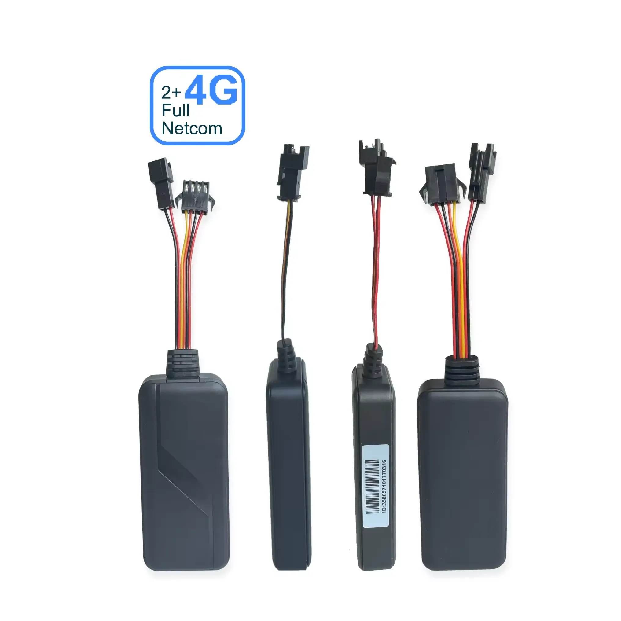
01 / WECHAT GPS4G Vehicle GPS Tracker with SOS Button, Microphone and Speaker

4G Vehicle GPS Tracker with SOS Button, Microphone and Speaker

This 4G Vehicle GPS Tracker combines real-time vehicle positioning with expandable emergency communication accessories. It supports an external SOS button, microphone, speaker and buzzer, making it suitable for fleet management, taxis, school buses, logistics vehicles and commercial transportation. OEM customers can customize the hardware, firmware, communication protocol and tracking platform.

Reference priceUSD 29.00
Explore product
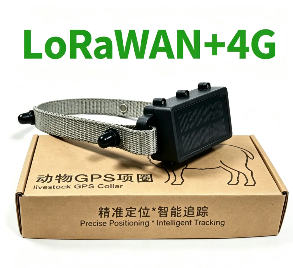
02 / WECHAT GPSSheep GPS Tracking Collar

Sheep GPS Tracking Collar

The Sheep GPS Tracking Collar is designed for real-time flock location, grazing-route monitoring and escape prevention. It supports GPS positioning, configurable location uploads, electronic geofences and historical route playback. Waterproof construction, low-power operation and optional LoRaWAN or 4G communication make it suitable for large farms, open pastures and remote grazing areas.

Reference priceUSD 52.00
Explore product
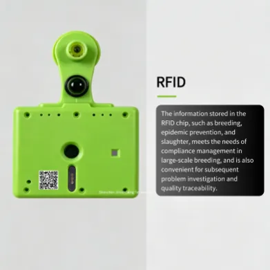
03 / WECHAT GPSPasture Livestock Tracking Ear Tag with GPS and LoRaWAN

Pasture Livestock Tracking Ear Tag with GPS and LoRaWAN

The Pasture Livestock Tracking Ear Tag is designed for cattle, sheep, and other grazing animals that require long-range location tracking and digital herd management. It combines GPS positioning, LoRaWAN communication, activity monitoring, temperature sensing, RFID identification, and geo-fence alerts in one compact livestock ear tag. The device is suitable for large farms, open pasture, remote grazing areas, and livestock IoT projects where farmers need to monitor animal location and movement from a web platform or mobile app. LoRaWAN communication can reduce the need for a cellular SIM card on each device, while optional 4G connectivity can be used for specific project requirements.

Reference priceUSD 56.00
Explore product
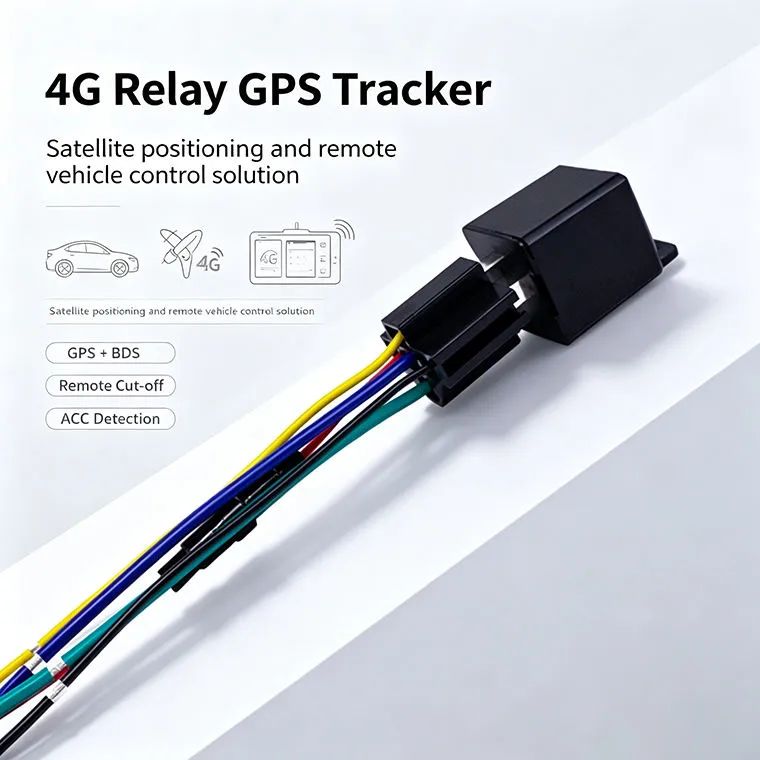
04 / WECHAT GPS4G Relay GPS Tracker for Cars

4G Relay GPS Tracker for Cars

A discreet 4G relay GPS tracker designed for concealed vehicle installation. It supports GPS and BeiDou positioning, real-time tracking, geo-fence alerts, ACC detection and optional remote fuel or power cut-off through a mobile app or web platform.

Reference priceUSD 23.00
Explore product
06 / WECHAT GPSMagnetic Asset GPS Tracker

Magnetic Asset GPS Tracker

Professional Asset GPS Tracker with 4G & LoRaWAN support. High-precision GNSS asset tracking, solar charging, tamper-proof design, and private cloud integration. Ideal for livestock, equipment, and outdoor asset monitoring with CE & RoHS certification.

Reference priceUSD 59.00
Explore product

Implementation process

  1. 01

    Requirements

    Define the application, country, quantity, reporting interval and target battery life.

  2. 02

    Technical design

    Agree the device, network, power system, payload and platform interfaces.

  3. 03

    Prototype validation

    Test representative devices, coverage, power consumption and alarm delivery on site.

  4. 04

    Production and rollout

    Approve the specification and pilot results, then plan production, installation and support.

Pilot acceptance

  • The customer’s logo, colors, company name and domain display correctly.

  • The web platform opens correctly on current desktop and mobile browsers.

  • Android and iOS applications display the approved white-label branding.

  • Each tenant can access only its own users, devices and location data.

  • Distributor and reseller accounts can create and manage authorized subaccounts.

  • Unauthorized accounts cannot view devices outside their assigned organization.

  • Supported GPS devices establish stable TCP, UDP, MQTT or HTTP connections.

  • Every integrated device model reports the correct device identifier.

  • Location messages display the correct latitude, longitude, time, speed and direction.

  • Heartbeat messages update device online status correctly.

  • Alarm messages are classified and displayed according to the protocol.

  • Sensor values use the correct units and data formats.

  • Historical routes can be queried for the agreed storage period.

  • Route playback follows the correct chronological order.

  • Geofence entry and exit alarms operate according to the configured rules.

  • Low-battery, external-power, SOS, offline and tamper alarms operate where supported.

  • Remote commands are transmitted to compatible devices and return an execution status.

  • Offline commands are queued or rejected according to the agreed business logic.

  • Mobile push notifications reach the assigned Android and iOS users.

  • Email, SMS or webhook notifications operate when included in the project.

  • Google Maps, Amap or the selected map service loads in the target regions.

  • The REST API returns the documented fields, timestamps and status codes.

  • API authentication, rate limiting and permission controls operate correctly.

  • Bulk device import and export functions work with the approved file format.

  • The platform supports the agreed concurrent device connections.

  • The platform processes the agreed message rate during load testing.

  • PostgreSQL, Redis and ClickHouse operate without data inconsistency during testing.

  • Service monitoring identifies abnormal CPU, memory, database and connection conditions.

  • Automatic backups complete successfully according to schedule.

  • A sample database restoration is completed successfully.

  • The system reconnects devices after a service restart or temporary network interruption.

  • Audit logs record logins, configuration changes, data exports and remote commands.

  • Data-retention and deletion rules operate according to the customer’s policy.

  • Pilot users and devices complete the agreed field-test period before final acceptance.

Frequently asked questions

Can we evaluate samples first?+

Sample availability, quantity and lead time depend on the selected model. Confirm the pilot scope before placing a production order.

Can we use our own platform and branding?+

Logo, packaging, firmware, payloads and API integration can be assessed within the agreed OEM / ODM scope.

How are battery life and coverage confirmed?+

Reporting interval, installation, radio conditions and temperature affect results. Confirm the operating profile and validate it during the pilot.

What should we provide for a quotation?+

Share the country, device quantity, application, network, power target and platform requirements. Include drawings or interface documents when available.

Discuss your project

Tell us about your project

Share your requirements for product selection and customization support.

jietainana@gmail.com