Hardware & PCB design
PCB, enclosure, connectors, antenna and power design are reviewed against the installation and operating requirements.

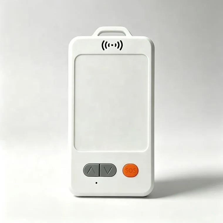
The JSC-802R is a high-precision wearable personnel tracker developed for construction sites, open-pit mines, ports, energy facilities, industrial parks and other safety-critical workplaces. It combines RTK GNSS outdoor positioning with optional UWB, Bluetooth and Wi-Fi technologies for indoor and semi-indoor location monitoring. In open outdoor environments, the device can receive RTK correction data to deliver centimeter-level positioning under suitable satellite and network conditions. When a worker enters a building, tunnel, workshop or GNSS-denied area, the system can switch to UWB or Bluetooth-assisted positioning instead of relying on unstable indoor GPS signals. The JSC-802R also supports SOS alarms, man-down detection, configurable geofences, route history and worker-status monitoring. Location and alarm data can be transmitted through 4G, LoRa or a customized communication architecture and displayed on a web platform, Android application or iOS application.
Final pricing depends on configuration, quantity, taxes and shipping.
Sample availability, quantity and lead time depend on the selected model. Confirm the pilot scope before placing a production order.
The JSC-802R is a wearable RTK GNSS personnel tracker developed for high-precision outdoor worker positioning and industrial safety management. It combines multi-constellation satellite positioning, optional RTK correction data, 4G or LoRaWAN communication, SOS alarms and motion-based safety monitoring in a compact wearable terminal.
Unlike a standard employee GPS badge that only provides approximate location information, the JSC-802R is designed for projects that require more precise outdoor personnel positioning. When the device has a clear satellite view and receives valid RTK correction data, it can provide centimeter-level location results under suitable operating conditions.
The tracker is suitable for construction sites, open-pit mines, ports, container yards, oil and gas fields, power facilities, large farms and industrial parks. Workers can wear it using a lanyard, clip or customized mounting accessory.
Two communication versions are available. The 4G version sends location and alarm data directly to the server through a cellular network. The LoRaWAN version communicates with a nearby LoRaWAN gateway and does not require a SIM card in every personnel badge.
RTK, or Real-Time Kinematic positioning, improves standard GNSS accuracy by applying correction data from a reference station or network correction service.
A conventional GPS personnel tracker normally provides meter-level positioning. This may be sufficient for general workforce visibility but may not accurately distinguish between workers operating near adjacent machines, restricted zones or closely spaced work areas.
The JSC-802R can use RTK correction data to improve outdoor positioning accuracy. Under clear-sky conditions, with suitable satellite geometry and stable correction data, the device can provide centimeter-level positioning for safety and operational applications.
Supported positioning capabilities can include:
Actual accuracy depends on the selected GNSS module, antenna design, satellite visibility, correction service, surrounding structures and installation conditions.
The JSC-802R can be configured with either 4G cellular communication or LoRaWAN communication. The appropriate version should be selected according to network coverage, operating area, battery-life requirements and deployment scale.
The 4G version connects directly to the mobile network and uploads data to the server without requiring an on-site LoRaWAN gateway.
It is suitable for:
Each 4G device normally requires a SIM card and an active data plan. Communication costs and power consumption depend on the reporting frequency, network signal and data volume.
The LoRaWAN version sends data to an on-site LoRaWAN gateway. The gateway then forwards the data to the server through 4G, Ethernet or Wi-Fi.
It is suitable for:
The LoRaWAN badge does not require an individual SIM card. This can reduce recurring communication costs when many devices are deployed within the same managed area.
Available LoRaWAN frequency configurations include:
The final frequency must comply with the radio regulations of the deployment country.
The JSC-802R includes a physical SOS button that allows a worker to request assistance immediately.
When the SOS button is activated, the device can transmit:
The platform displays the alarm on the personnel map and can notify supervisors through web alerts, mobile applications or customized interfaces.
SOS functionality is especially useful for lone workers, maintenance teams, security staff, construction personnel and employees operating in remote or hazardous outdoor locations.
A built-in motion sensor can monitor movement, posture and activity status. The firmware can be configured to detect suspected falls, prolonged tilt or abnormal inactivity.
Available safety rules may include:
The system can allow a short cancellation period before sending the final alert. This helps reduce false alarms caused by normal bending, sitting or accidental device movement.
Because motion-based alarms depend on wearing position and worker activity, alarm thresholds should be verified during a field trial.
The management platform allows administrators to create virtual boundaries around operational and restricted areas.
Supported geofence applications include:
When a geofence rule is triggered, the platform records the worker, position, alarm time and event type.
RTK positioning can improve boundary determination in open outdoor areas where ordinary GPS accuracy may be insufficient.
The JSC-802R can connect to a web-based workforce safety platform, Android application and iOS application.
Platform functions can include:
The platform can associate each device ID with the worker’s name, department, role, contact information and emergency details.
The platform stores position reports according to the configured data-retention policy.
Authorized users can review:
Historical records can support incident investigation, safety reviews, patrol verification and workforce deployment analysis.
The location history should be managed according to applicable privacy, employee-monitoring and data-protection requirements.
RTK positioning and frequent 4G transmission require more energy than occasional standard GPS reporting. The JSC-802R therefore supports configurable positioning and communication strategies.
Available power-management modes may include:
For example, the device can report less frequently while a worker remains stationary and automatically increase the reporting frequency when movement or an emergency is detected.
Battery life depends on:
Battery-life claims should always be based on a defined reporting configuration and real deployment conditions.
Product model: JSC-802R
Product category: Wearable personnel tracking badge
Primary function: High-precision outdoor worker positioning and safety monitoring
Positioning environment: Outdoor and semi-open areas with sufficient satellite visibility
Application: Construction, mining, ports, utilities, energy, agriculture and industrial safety
Wearing options: Lanyard, chest clip, arm strap or customized holder
OEM and ODM: Supported
Positioning technology: RTK GNSS and standard GNSS
Satellite systems: GPS, BeiDou, GLONASS and Galileo, depending on module configuration
RTK correction method: Network RTK or local reference station
RTK accuracy: Centimeter-level under suitable outdoor conditions
Standard GNSS accuracy: Meter-level under normal outdoor conditions
Positioning interval: Remotely configurable
Emergency positioning: High-frequency reporting after an SOS or safety alarm
Fallback mode: Standard GNSS positioning when RTK correction is unavailable
Location storage: Local storage supported during communication interruption
Data retransmission: Stored location records can be uploaded after network recovery
Communication version: 4G or LoRaWAN
4G network: Regional LTE configuration according to project requirements
2G fallback: Optional, depending on the selected cellular module and local network
LoRaWAN protocol: Regional configuration according to project requirements
LoRaWAN frequency bands: CN470, IN865, EU868, RU864, US915, AU915, KR920 and AS923 series
SIM-card requirement: Required for direct 4G communication
LoRaWAN SIM-card requirement: No SIM card required inside the badge
Gateway requirement: Required for the LoRaWAN version
Server protocol: TCP, UDP, MQTT, HTTP or customized protocol
API: REST API or customized integration
Firmware upgrade: OTA upgrade available according to project configuration
Remote commands: Supported
SOS button: Supported
Man-down detection: Supported
Fall detection: Configurable
Inactivity detection: Configurable
Tilt detection: Configurable
Geofence alarm: Supported
Restricted-area alarm: Supported
Low-battery alarm: Supported
Device-offline alarm: Supported
Tamper or removal alarm: Optional
Local warning: Optional buzzer, vibration or LED indication
Motion sensor: Six-axis accelerometer and gyroscope
SOS input: Physical emergency button
LED indicator: Power, network and alarm status
Vibration motor: Optional
Buzzer: Optional
NFC or RFID: Optional for employee identification
Temperature sensor: Optional
Power source: Built-in rechargeable lithium battery
Battery capacity: Selected according to enclosure and operating requirements
Charging method: Magnetic charging, USB charging or charging dock, depending on version
Power protection: Overcharge, over-discharge and short-circuit protection
Power-saving modes: Deep sleep, motion wake-up, scheduled positioning and adaptive reporting
Low-battery notification: Supported
Battery status upload: Supported
Enclosure material: Industrial-grade ABS and PC, subject to final configuration
Protection level: IP67 or IP68 according to the selected enclosure
Installation method: Wearable or customized mounting
Color: Standard or customized
Logo: Printing, laser engraving or customized label
Dimensions: According to the selected JSC-802 enclosure
Weight: According to the battery, communication module and enclosure
Operating temperature: Subject to final component and battery configuration
Storage temperature: Subject to final product configuration
The JSC-802R can monitor workers across large construction sites and send alerts when personnel enter excavation areas, crane operating zones or other restricted locations.
RTK positioning can help distinguish workers operating near haul roads, mining vehicles, slopes and high-risk production areas in open-pit mines.
The system can monitor personnel across outdoor loading areas, container yards and restricted vehicle routes.
Remote workers can use SOS and man-down functions while supervisors monitor location and alarm status from the control center.
The device can be assigned to inspection workers, line-maintenance teams and personnel operating across outdoor substations or energy facilities.
The JSC-802R can monitor field workers, ranch employees and maintenance teams operating across large farms or grazing areas.
Historical routes and geofence records can support outdoor patrol verification and restricted-area management.
For the 4G version, each badge contains a cellular communication module and SIM card.
The basic data flow is:
JSC-802R badge → 4G mobile network → application server → web platform or mobile application
This architecture is relatively simple and suitable for mobile workers or projects covering several geographically separated areas.
Before deployment, the customer should confirm:
For the LoRaWAN version, personnel badges communicate with one or more gateways installed within the project area.
The basic data flow is:
JSC-802R badge → LoRaWAN gateway → 4G, Ethernet or Wi-Fi backhaul → application server → management platform
This architecture eliminates the need for a SIM card in every badge and is suitable for large fixed sites.
Gateway planning should consider:
Actual LoRaWAN coverage must be verified through on-site testing. Theoretical coverage distance should not be used as the only basis for deployment.
To achieve high-precision RTK positioning, the project requires more than an RTK-capable badge.
The complete system may include:
The customer should confirm whether a local RTK base station or an existing network correction service is available in the deployment country.
Shenzhen Jinshengchang Technology Co., Ltd. provides customization services for the JSC-802 series.
Available services include:
The system can be connected to the lora8 platform or deployed on a customer-controlled Linux server.
RTK centimeter-level positioning is intended primarily for outdoor environments with a clear satellite view.
Buildings, roofs, tunnels, dense trees, metal structures and underground environments can block or reflect satellite signals and reduce accuracy.
The JSC-802R should not be marketed as an indoor centimeter-level positioning device unless an additional dedicated indoor positioning technology is integrated.
When RTK correction data become unavailable, the device can continue operating with standard GNSS positioning, but the accuracy will normally return to the meter level.
Final positioning performance must be confirmed through field testing at the actual project location.
The JSC-802R combines high-precision outdoor positioning, industrial personnel safety functions and flexible communication in one wearable device.
Key advantages include:
Yes. The RTK version can provide centimeter-level positioning under suitable outdoor conditions with sufficient satellite visibility and valid RTK correction data. Final accuracy depends on the environment and system configuration.
No. RTK GNSS depends on satellite signals and is primarily intended for outdoor use. Indoor centimeter-level positioning requires an additional technology such as UWB, which is not included in this version.
No. The LoRaWAN badge sends its data to a LoRaWAN gateway and does not require an individual SIM card. The gateway still requires an internet connection through 4G, Ethernet or Wi-Fi.
Yes. Each 4G badge normally requires a compatible SIM card and mobile-data service.
The tracker can fall back to standard GNSS positioning. Location data can continue to be reported, but the accuracy will normally change from centimeter level to meter level.
Yes. The JSC-802R supports customized communication protocols, API integration and private Linux server deployment.
Yes. The platform can manage multiple companies, projects, departments, sites, user roles and device groups.
Yes. OEM and ODM services are available for hardware, firmware, enclosure, wearing method, communication protocol, logo, application and platform.
Reference configurations are shown below. Final specifications are confirmed in the approved product specification.
| Cellular network | 4G LTE with optional 2G fallback, depending on regional module |
|---|---|
| LoRa communication | Optional |
| Bluetooth | Optional BLE communication and beacon scanning |
| Wi-Fi | Optional Wi-Fi scanning or network communication |
| UWB | Optional high-precision indoor positioning |
| SIM card | Required for direct 4G communication |
| LoRa SIM requirement | No SIM card is required when location data are transmitted only through a LoRa gateway |
| Data protocol | TCP, UDP, MQTT, HTTP or customized protocol |
| API integration | REST API or customized server interface |
| Offline storage | Supports local data storage when the network is unavailable |
| Data retransmission | Stored records can be uploaded after communication is restored |
| Remote configuration | Supported according to firmware and network configuration |
| Firmware upgrade | OTA firmware upgrade available for supported versions |
| SOS alarm | Dedicated emergency button |
| Man-down alarm | Supported through motion and posture detection |
| Fall detection | Configurable through six-axis motion-sensor data |
| Inactivity alarm | Detects prolonged absence of movement |
| Tilt alarm | Configurable angle and duration |
| Geofence alarm | Entry, exit and restricted-area alerts |
| Danger-zone warning | Platform alarm, vibration, buzzer or customized local warning |
| Low-battery alarm | Supported |
| Device-offline alarm | Supported |
| Tamper alarm | Optional |
| Overtime stay alarm | Alerts when a worker remains in a designated area longer than permitted |
| Personnel-counting function | Supports zone-based worker statistics through the platform |
Step 1 – Site assessment: Confirm the indoor and outdoor areas, building structure, dangerous zones, required accuracy and number of workers.
Step 2 – Technology selection: Use RTK GNSS for open outdoor zones, UWB for centimeter-level indoor areas and Bluetooth for ordinary areas.
Step 3 – Infrastructure planning: Determine the locations of RTK correction services, UWB anchors, Bluetooth gateways and communication gateways.
Step 4 – Device configuration: Register each badge ID and associate it with the corresponding employee profile.
Step 5 – Map configuration: Upload site maps and create permitted areas, restricted areas, assembly points and evacuation routes.
Step 6 – Alarm rules: Configure SOS, man-down, inactivity, low-battery, offline and geofence conditions.
Step 7 – Field calibration: Test positioning accuracy, anchor geometry, communication latency and alarm delivery in representative areas.
Step 8 – Pilot operation: Conduct a small deployment before releasing the system to the entire workforce.
Define the application, country, quantity, reporting interval and target battery life.
Agree the device, network, power system, payload and platform interfaces.
Test representative devices, coverage, power consumption and alarm delivery on site.
Approve the specification and pilot results, then plan production, installation and support.
PCB, enclosure, connectors, antenna and power design are reviewed against the installation and operating requirements.
Reporting intervals, event logic, payload encoding and remote configuration are defined in a versioned interface document.
Device registration, maps, history, alarms and customer APIs are scoped together with access permissions and data handling.
Logo, enclosure color, labels, packaging and white-label interfaces can be assessed for the selected product and order quantity.
Sample availability, quantity and lead time depend on the selected model. Confirm the pilot scope before placing a production order.
Logo, packaging, firmware, payloads and API integration can be assessed within the agreed OEM / ODM scope.
Reporting interval, installation, radio conditions and temperature affect results. Confirm the operating profile and validate it during the pilot.
Share the country, device quantity, application, network, power target and platform requirements. Include drawings or interface documents when available.
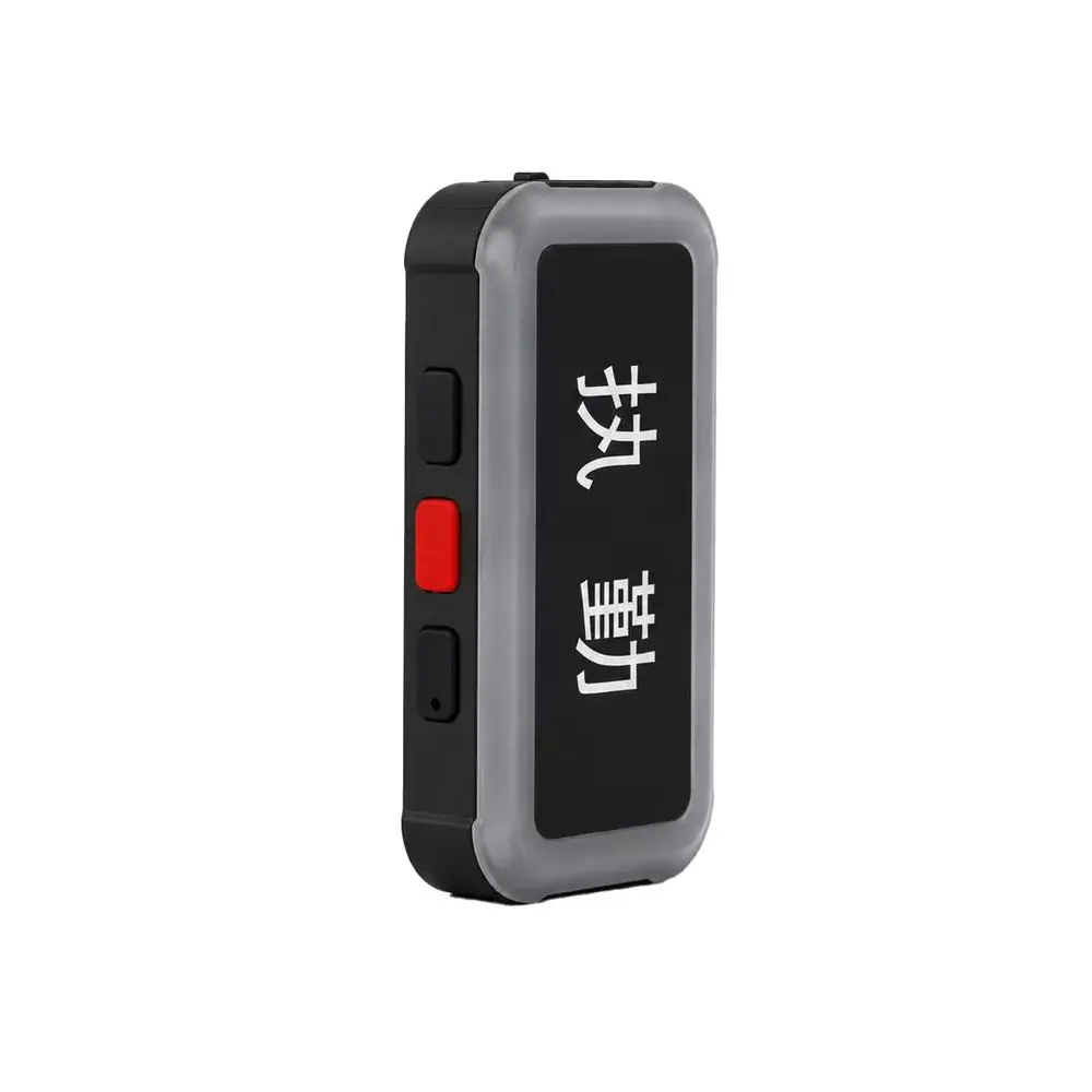
The GPS Shoulder Light Tracker is a compact wearable safety and positioning device for patrol officers, security guards, road workers and field personnel. It combines GPS, BeiDou, WiFi and LBS positioning with 4G Cat.1 communication, BLE 5.1 and a high-visibility LED matrix display. Managers can monitor personnel locations, online status and movement history through a web platform or mobile application.
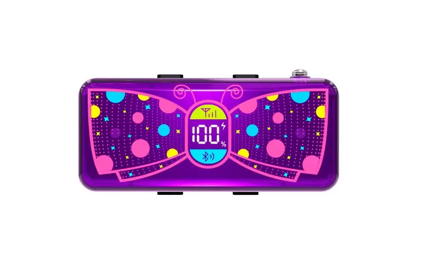
The GPS Shoulder Warning Light combines high-visibility LED warning, real-time personnel tracking and emergency communication in one compact wearable device. It supports GPS positioning, 4G connectivity, SOS alarms, electronic geofencing and historical route playback, making it suitable for security patrols, traffic control, construction sites, railway maintenance and lone-worker protection.
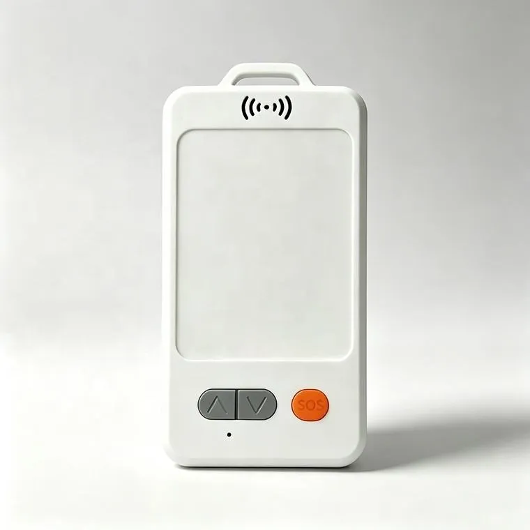
The JSC-802 is a wearable 4G employee badge that gives control centers live workforce visibility, rapid SOS notification, location history, and zone-based safety monitoring for industrial and field operations.