Hardware & PCB design
PCB, enclosure, connectors, antenna and power design are reviewed against the installation and operating requirements.

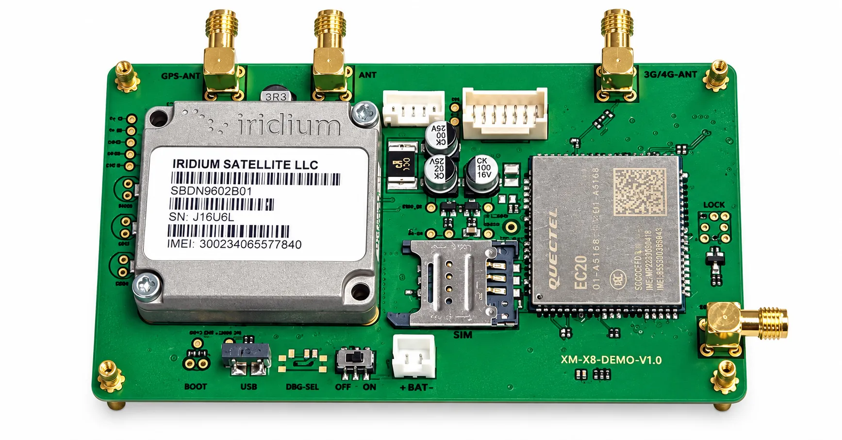
The Direct-to-Satellite GPS Tracker combines GNSS positioning with satellite data communication to track vehicles, boats, containers, equipment, personnel and animals in areas without cellular coverage. Location and alarm data can be transmitted directly to a supported satellite network without relying on a conventional 2G, 3G or 4G base station. The device does not require a conventional cellular SIM card, but satellite network activation, a device identity and a satellite service plan may still be required. Shenzhen Jinshengchang Technology provides customized hardware, satellite-module integration, low-power PCBA design, embedded firmware, antenna development, tracking platform, API integration, prototype production and OEM manufacturing.
Final pricing depends on configuration, quantity, taxes and shipping.
Sample availability, quantity and lead time depend on the selected model. Confirm the pilot scope before placing a production order.
【Solution Advantages】
Provides tracking coverage beyond conventional cellular-network areas.
Eliminates dependence on terrestrial mobile base stations.
Does not require a conventional cellular SIM card in satellite-only mode.
Supports remote assets that cannot be inspected frequently.
Combines GNSS positioning, satellite communication, sensors and alarms in one device.
Allows flexible reporting strategies to balance tracking frequency and battery life.
Supports customized PCBA, firmware, antennas, enclosures and software platforms.
Can be developed for vehicles, assets, personnel, boats or livestock.
Supports integration with the customer’s existing platform through an API.
Provides a complete path from initial concept to prototype and mass production.
【Content】
A Direct-to-Satellite GPS Tracker is designed for locations where conventional mobile networks are unavailable, unstable or too expensive to deploy. The device combines GNSS positioning with a satellite communication module, allowing coordinates and alarm data to be transmitted through a supported satellite network.
GNSS and satellite communication perform different functions. The GNSS receiver calculates the device position by receiving navigation signals from GPS, BDS, GLONASS or Galileo satellites. The satellite communication module then sends that position and other device information to a communication satellite. The message is transferred through a ground station to the tracking platform.
In satellite-only mode, the tracker does not need a conventional cellular SIM card or a nearby 2G, 3G or 4G base station. However, satellite communication normally requires network activation, a registered device identity and a service plan from the selected satellite operator. This distinction should be explained clearly to customers.
Satellite data transmission normally consumes more power than a short local wireless message. A successful low-power design therefore requires coordinated optimization of the hardware, firmware, antenna and reporting strategy. The tracker can remain in deep sleep for most of the time, wake according to a schedule or motion event, obtain a GNSS position, transmit a compact satellite message and then return to sleep.
The communication frequency can be adjusted according to the application. A container tracker may report only several times per day, while an emergency device may transmit more frequently after the SOS button is activated. A livestock tracker can use slower reporting when the animal remains inside a safe area and faster reporting after it crosses a virtual boundary.
Satellite antenna performance is critical. The device should normally have a suitable view of the sky, and the antenna should not be blocked by metal structures. For vehicles, containers and machinery, an external antenna or a carefully selected mounting position may be required. The PCB, enclosure and antenna must therefore be developed as one complete RF system.
Shenzhen Jinshengchang Technology provides customized development for satellite tracking products, including circuit architecture, PCB layout, satellite-module integration, embedded firmware, communication protocols, GNSS and satellite antenna design, tracking platforms, mobile applications and API integration.
With 13 years of GPS research and development experience, our team can support satellite trackers for vehicles, maritime applications, industrial assets, outdoor personnel, livestock and emergency equipment. Services include requirement evaluation, prototype production, field testing, pilot production and OEM manufacturing.
Reference configurations are shown below. Final specifications are confirmed in the approved product specification.
| Product Type | Direct-to-satellite GPS tracking device. |
|---|---|
| Positioning System | GPS, BDS, GLONASS and Galileo options. |
| Communication | Direct satellite communication through a selected satellite network. |
| Cellular SIM Card | Not required for satellite-only communication. |
| Satellite Service | Network activation and a satellite service plan may be required. |
| Communication Direction | One-way uplink or two-way satellite messaging, depending on the selected module and network. |
| Tracking Modes | Real-time tracking, scheduled tracking, motion tracking and emergency tracking. |
| Data Transmission | Position, time, speed, direction, battery status, sensor data and alarm information. |
| Processor | Low-power MCU or satellite module with integrated processing. |
| PCBA | Customized compact multilayer PCBA with GNSS, satellite communication and power-management circuits. |
| Antenna | Integrated or external GNSS and satellite communication antennas. |
| Power Supply | Rechargeable battery, primary lithium battery, vehicle power or solar charging. |
| Power Management | Deep sleep, timed wake-up, motion wake-up and adaptive reporting. |
| Sensors | Accelerometer, temperature sensor, light sensor and Hall sensor options. |
| Alarm Functions | SOS, geofence, movement, tamper, low battery and abnormal-condition alerts. |
| Data Storage | Local offline storage with automatic retransmission. |
| Communication Protocol | MQTT, TCP, UDP, HTTPS or customized satellite data protocol, subject to network support. |
| Platform Access | Web platform, Android APP, iOS APP and API. |
| Firmware Upgrade | Local firmware update or remote update when supported by the communication channel. |
| Protection Rating | IP67 or IP68 enclosure options. |
| Customization | PCBA, firmware, enclosure, antenna, LOGO, packaging, APP and platform. |
| 【Satellite Communication Solution】 | |
| The device obtains its coordinates through a GNSS receiver. | |
| The embedded processor collects location, battery, movement and sensor information. | |
| The firmware compresses the data into a satellite-compatible packet. | |
| The satellite communication module transmits the packet directly to the selected satellite network. | |
| The satellite operator forwards the data to a ground station or cloud service. | |
| The customer’s tracking server receives and processes the location data through an API or network interface. | |
| The web platform and mobile APP display the device location, historical route, alarm status and battery level. | |
| Remote commands can be sent back to the device when the selected network and hardware support two-way communication. | |
| 【Communication Architecture】 | |
| GNSS Satellites | Provide positioning and time information to the tracker. |
| Tracking Device | Collects coordinates, sensor data and alarm information. |
| Communication Satellite | Receives data directly from the tracking device. |
| Ground Station | Transfers satellite messages to the internet or cloud service. |
| Tracking Platform | Processes device data and stores location history. |
| Mobile APP and Web Portal | Display location, routes, alarms and device status. |
| API Interface | Connects satellite tracking data with the customer’s existing system. |
| 【No-SIM Operating Principle】 | |
| The tracker does not use a conventional cellular SIM card when operating in satellite-only mode. | |
| The device communicates through a compatible satellite modem and satellite antenna. | |
| Each tracker is normally registered using a satellite device identity or network account. | |
| The satellite network operator may charge activation, message or subscription fees. | |
| No cellular base station is required, making the device suitable for locations outside mobile-network coverage. | |
| A hybrid satellite and cellular version can also be developed if the customer requires automatic network switching. | |
| 【Power-Saving Strategy】 | |
| Scheduled Positioning | The tracker wakes at a predefined interval, obtains a position and returns to sleep. |
| Motion Wake-Up | An accelerometer activates tracking when movement is detected. |
| Adaptive Reporting | Reporting frequency changes according to movement, alarms and battery level. |
| Packet Optimization | Compact satellite messages reduce transmission time and energy consumption. |
| Transmission Retry Control | Failed messages are stored and retransmitted according to a controlled retry strategy. |
| GNSS Optimization | Assisted positioning and optimized acquisition logic reduce satellite-search time. |
| Deep Sleep | The MCU, GNSS receiver and communication module enter low-power mode between reports. |
| Battery Monitoring | The system records voltage and sends low-battery notifications. |
| Solar Charging | Optional solar power can support long-term outdoor deployment. |
| Emergency Mode | The reporting frequency increases automatically after an SOS or critical alarm. |
| 【PCBA Design 】 | |
| The PCBA integrates the GNSS receiver, satellite communication module, low-power MCU, power-management circuit and sensor interfaces. | |
| The PCB dimensions can be customized according to the enclosure and installation method. | |
| RF traces are designed according to the antenna impedance and module requirements. | |
| GNSS and satellite communication circuits are separated to reduce interference. | |
| The power circuit is optimized for the current peaks generated during satellite transmission. | |
| Protection circuits can include ESD, overvoltage, overcurrent, reverse-polarity and battery protection. | |
| Programming and test points are reserved for firmware loading, production testing and maintenance. | |
| Optional interfaces include UART, I²C, SPI, ADC, GPIO, RS232, RS485 and CAN. | |
| Two-layer, four-layer or multilayer PCB designs are available according to size and RF requirements. | |
| Component selection considers availability, operating temperature, lifecycle and mass-production cost. | |
| 【Antenna Design 】 | |
| The GNSS antenna receives positioning signals from navigation satellites. | |
| The communication antenna transmits and receives data through the selected satellite network. | |
| Antenna type and dimensions depend on the operating frequency, satellite network and enclosure. | |
| The antenna area must be kept away from batteries, metal brackets and high-noise circuits. | |
| RF impedance, ground clearance and antenna matching are considered during PCB layout. | |
| The final antenna performance is tested after the PCBA is installed inside the enclosure. | |
| External antennas can be used for vehicles, containers and metal equipment. | |
| Integrated antennas can be developed for portable, wearable and compact tracking devices. | |
| The device should have a suitable view of the sky for reliable satellite communication. | |
| 【Firmware Functions 】 | |
| GNSS acquisition and coordinate processing. | |
| Satellite-network registration and message transmission. | |
| Scheduled, motion-based and emergency tracking modes. | |
| Configurable positioning and reporting intervals. | |
| One-way or two-way messaging according to network capability. | |
| SOS alarm and emergency-location reporting. | |
| Geofence entry and exit detection. | |
| Movement, vibration and tamper alarms. | |
| Low-battery monitoring and power-saving control. | |
| Offline data storage and automatic retransmission. | |
| Remote parameter configuration when downlink communication is supported. | |
| Device diagnostics, restart protection and watchdog control. | |
| Data encryption and device authentication options. | |
| Local or remote firmware upgrade according to hardware capability. | |
| 【Tracking Platform 】 | |
| Live device-location display. | |
| Historical route playback. | |
| Satellite-message status monitoring. | |
| Device battery and operating-status display. | |
| Geofence creation and alarm management. | |
| SOS and emergency-event processing. | |
| Offline-device and communication-failure alerts. | |
| Vehicle, asset, personnel or animal grouping. | |
| Multiple device management through one account. | |
| Role-based user and distributor management. | |
| Android and iOS mobile APP support. | |
| Web-based monitoring center. | |
| Custom maps, languages, LOGO and interface design. | |
| API integration with logistics, fleet, rescue or asset-management systems. |
Confirm that the selected satellite network provides coverage in the intended operating region.
Activate the satellite device identity and service account before deployment.
Register the device ID on the tracking platform.
Configure positioning intervals, satellite reporting intervals and alarm rules.
Install the device with the satellite antenna facing toward an open area of the sky.
Avoid mounting the antenna under thick metal, inside a sealed metal cabinet or close to strong interference sources.
Use an external antenna when the tracker must be installed inside a vehicle or metal enclosure.
Perform a satellite communication test at the installation location.
Configure emergency mode, geofences and low-battery thresholds.
Confirm that location data is correctly displayed on the web platform and mobile APP.
Inspect the waterproof seal, charging interface and mounting structure before long-term outdoor use.
Define the application, country, quantity, reporting interval and target battery life.
Agree the device, network, power system, payload and platform interfaces.
Test representative devices, coverage, power consumption and alarm delivery on site.
Approve the specification and pilot results, then plan production, installation and support.
PCB, enclosure, connectors, antenna and power design are reviewed against the installation and operating requirements.
Reporting intervals, event logic, payload encoding and remote configuration are defined in a versioned interface document.
Device registration, maps, history, alarms and customer APIs are scoped together with access permissions and data handling.
Logo, enclosure color, labels, packaging and white-label interfaces can be assessed for the selected product and order quantity.
Sample availability, quantity and lead time depend on the selected model. Confirm the pilot scope before placing a production order.
Logo, packaging, firmware, payloads and API integration can be assessed within the agreed OEM / ODM scope.
Reporting interval, installation, radio conditions and temperature affect results. Confirm the operating profile and validate it during the pilot.
Share the country, device quantity, application, network, power target and platform requirements. Include drawings or interface documents when available.
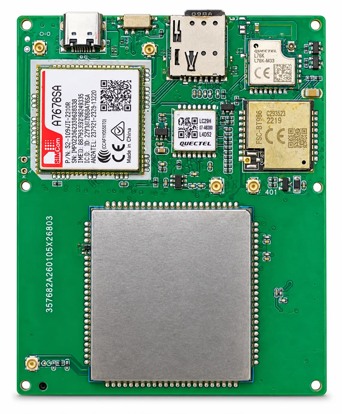
Satellite GNSS Tracker PCB Design is a customized hardware-development service combining GNSS positioning, direct satellite communication, power management, antenna integration and optional terrestrial communication on one compact PCBA. The design can support satellite communication without a conventional cellular SIM card. Optional LoRa, 4G and 2G modules can also be integrated for hybrid tracking applications that require automatic communication switching. Shenzhen Jinshengchang Technology provides schematic design, PCB layout, component selection, embedded firmware, antenna tuning, communication protocol development, prototype production, testing and mass-production support.